
Michigan Travel · Upper Peninsula
Munising Falls is closed. H-58 is the day.
MUNISING, Mich. — The paved trail to Munising Falls is closed, and Alger County Road H-58 runs 52 miles from this city to Grand Marais.
The National Park Service's plan-your-visit page for Pictured Rocks National Lakeshore, updated Oct. 3, says the falls are closed until further notice because of storm damage on the trail. The waterfalls page, updated Aug. 19, says the closure dates to storm damage in April 2025. The visitor centers page, updated Sept. 12, calls it a washout in 2025. The falls are inside the Munising city limits, an 800-foot paved walk to a 50-foot drop. That was the easy stop. It is not open.
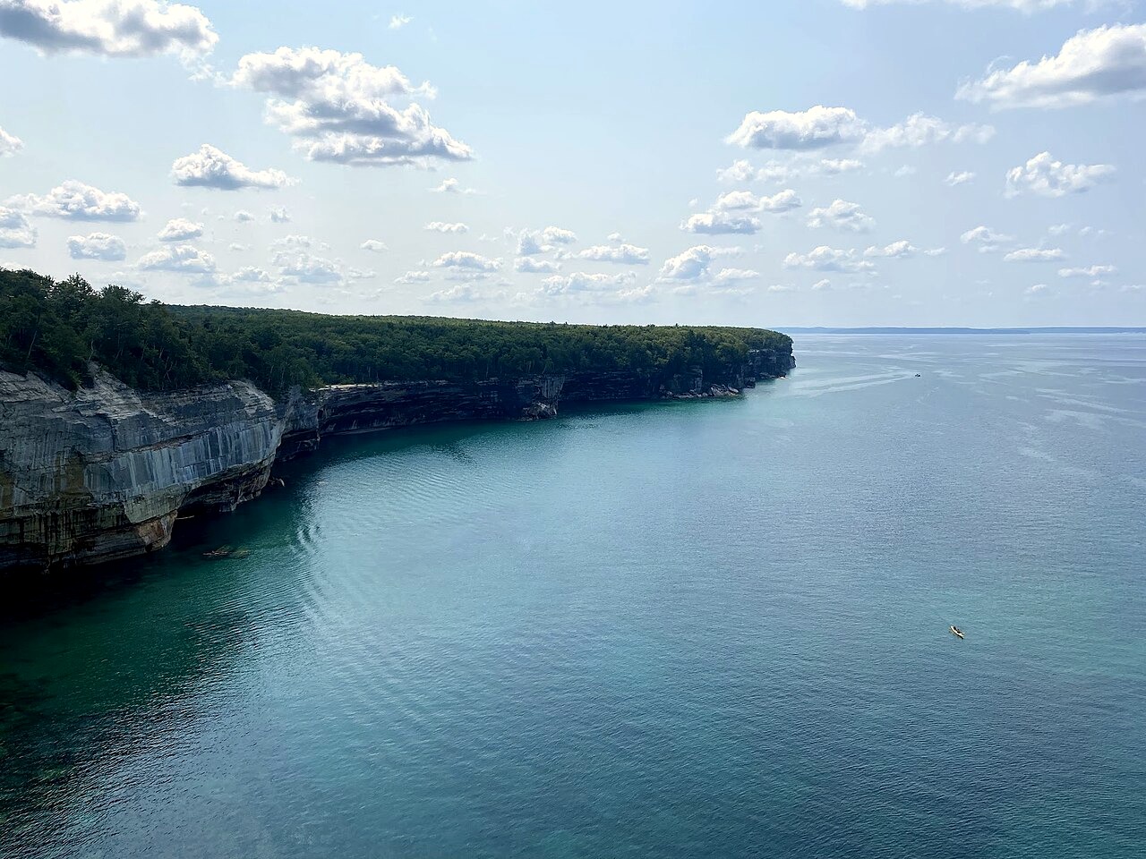
The park says this was the first national lakeshore, established in 1966, on the south shore of Lake Superior between Munising and Grand Marais. It describes some 15 miles of cliffs along a 42-mile shore, and nearly 100 miles of trail. H-58 is the road through it. The park's mileage chart, measured from the H-58 and M-28 circle in Munising, lists the H-58 and M-77 intersection in Grand Marais at 52.0 miles.
A private-vehicle pass is $25 for seven consecutive days. The park does not take cash. The fee page lists card-only sales at the Munising Falls Visitor Center, the Grand Sable Visitor Center and the Miners Castle Visitor Contact Station. Automated machines at Munising Falls and Miners Castle also sell a seven-day pass. The same page names six contracted merchants in the two towns. Sunday is not on the 2026 free-entrance list. The October date on that list is Oct. 27, and those free days are limited to U.S. citizens and residents. The fee page says the charge supports visitor services and improvements, including waysides, campsites, public use areas and accessibility work. The pass does not reopen the trail in town.
Miners Castle is the overlook already on this road. The plan page calls it the only cliff area reachable by car, about 10 miles outside Munising: east on H-58, then six miles up the spur it calls Miners Road. The waterfalls page calls that spur Miners Castle Road, or H-11. A short paved path leads from the lot. Miners Falls is a separate walk, from a lot about 4 miles north of H-58, then 0.6 miles to a drop of about 50 feet. Both are on the west end. Neither is Grand Marais.
The Au Sable Light Station is a walk, not a pull-off. The maritime page says to drive 12 miles west of Grand Marais on H-58 to the lower Hurricane River day-use lot, then walk 1.5 miles. It says tours are available for a fee in summer. It does not give an October tour time. Sable Falls, about a mile west of Grand Marais, is another walk, down a staircase of 168 steps. The plan page lists a 10-mile Chapel loop. The waterfalls page says the road to that trailhead is primitive. Stacking those onto the drive is how the light runs out.
In Munising on Sunday, sunrise is 7:49 a.m. and sunset is 7:20 p.m. That is 11 hours and 31 minutes of light, 3 minutes and 15 seconds shorter than Saturday, timeanddate.com reports. The hours page says the lakeshore is open 24 hours a day, though many roads close once snow covers them. The basic-information page says much of the park is out of cell range. The directions page says GPS and phone maps do not work well here, and that drivers should use the park map. It says H-58 is suitable for vehicles of all sizes, that long sections have very little shoulder or none, and that logging trucks and off-road vehicles use the road. The plan page tells fall visitors to drive the park roads for the changing leaves. It does not say the color is at a peak on Oct. 4.
The park does not say which kitchens are open. For restaurants it points visitors to local offices, including the Alger County Chamber of Commerce in Munising and the Grand Marais Chamber of Commerce. One shore, the Miners Castle overlook and the town at the end of H-58. That is the day.
Sources:
National Park Service, Pictured Rocks National Lakeshore, plan your visit, https://www.nps.gov/piro/planyourvisit/index.htm
National Park Service, Pictured Rocks National Lakeshore, waterfalls, https://www.nps.gov/piro/planyourvisit/waterfalls.htm
National Park Service, Pictured Rocks National Lakeshore, visitor centers, https://www.nps.gov/piro/planyourvisit/visitorcenters.htm
National Park Service, Pictured Rocks National Lakeshore, basic information, https://www.nps.gov/piro/planyourvisit/basicinfo.htm
National Park Service, Pictured Rocks National Lakeshore, road mileage, https://www.nps.gov/piro/planyourvisit/roadmileage.htm
National Park Service, Pictured Rocks National Lakeshore, fees and passes, https://www.nps.gov/piro/planyourvisit/fees.htm
National Park Service, Pictured Rocks National Lakeshore, operating hours and seasons, https://www.nps.gov/piro/planyourvisit/hours.htm
National Park Service, Pictured Rocks National Lakeshore, directions and transportation, https://www.nps.gov/piro/planyourvisit/directions.htm
National Park Service, Pictured Rocks National Lakeshore, maritime sites, https://www.nps.gov/piro/planyourvisit/maritime.htm
timeanddate.com, sunrise and sunset in Munising, October 2026, https://www.timeanddate.com/sun/usa/munising?month=10